top of page
iStock-placeholder.jpg
Surveys and Topography

Drones reduce field data collection time by up to 70%, keep field crews out of harm's way, and facilitate on-time and on-budget project completion. Topographic, ALTA, plats, and farm surveys are some of the projects types we completed alongside our clients.

Image-empty-state.png

EP Sports Complex

Topographic survey of hard-to-access, harsh, undeveloped terrain with steep slopes and thick, sharp bramble.

Image-empty-state.png

Edwardsville Marketplace

Mapping collection of all planimetric features (manmade and natural) and measurements of building heights.

Image-empty-state.png

Fuel Depot

The complex site consists of multiple major storage tanks, many smaller structures, several buildings, containment berms, retaining walls, and above ground pipings.

Image-empty-state.png

Green Bay Beef Processing

The client cut the schedule by 4 weeks using drone data collection. The industrial plant operates six days per week, limiting survey access to one day per week.

Image-empty-state.png

Harlem Avenue

The project involved mapping planimetric features (manmade and natural) within the right-of-way, including street furniture, curbs and gutters, sidewalks, drives, striping, utility structures, and utility surface location (JULIE) markings.

Image-empty-state.png

Hoeglund Subdivision

Surveying infill lots can be time-consuming. Topographic survey of vacant infill lots, adjacent lots, and roads in existing subdivision was completely quickly and on time.

Image-empty-state.png

McDade School

The surrounding properties include fenced yards, detached garages, and dense improvements, making data collection tedious, dangerous, (fence climbing, dogs, etc) and time consuming.

Image-empty-state.png

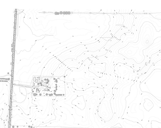
Mighty Greens Farm

Impending winter weather threatened the schedule for the topographic survey of farm, homestead, commercial farm buildings, and bisecting road. Drones slashed the time in the field and collected the data the day before snow blanketed the site.

Image-empty-state.png

Park Gate

An ALTA survey requiring all of the Standard Table A requirements, along with orthomosaic imagery, building heights and caliper of trees on site, was needed for this development project.

Image-empty-state.png

US I-90 and Rt 53 Interchange

Mapping included the edge of pavement, open areas, lighting, and storm culverts.

bottom of page